Quit our jobs, sold our home, gone riding...

Message
Author
User avatar
lightcycle
Veteran
Veteran
Posts: 61
Joined: Sat Feb 22, 2014 2:09 am
Real Name: Gene
Sex: Male
Years Riding: 11
My Motorcycle: 2006 R1200GS
Location: No fixed address

Re: Quit our jobs, sold our home, gone riding...

#11 Unread post by lightcycle »

Update from http://www.RideDOT.com/rtw/8.html on June 26, 2012

Image

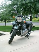
The Cabot Trail is the jewel of Atlantic Canada's tourism industry, especially if you're a motorcycle rider. It is considered by many to be a destination highway, like the Tail Of The Dragon in NC, Sea-to-Sky highway in BC, and the Stelvio Pass in Italy. We were camped the night before just outside of Cape Breton island and only had a couple of hundred kms to reach the beginning of the Cabot Trail in St Anns, after circumnavigating the south-east section of the island. The decision was to ride the coastal road of the Trail counter-clockwise so we would experience the scenery of the coast to our right.

Image
Back to group riding!

We left most of the planning and ride leading to Khanh, on his custom-painted VFR800, as he led us into the heart of Cape Breton. It was a really big change in rhythm as we rode with 6 other riders and at times we split up into two groups of four to keep things manageable, but the light traffic on the island meant stayed together as a group for the most part. The dynamics of group riding also changed with this many riders, as we had to make changes for different paces, following styles, endurance and also personalities.

Fortunately, we had all ridden with each other before and it was a quick adjustment to find a group order and pace that we were all familiar with. Neda and I met these guys at a group ride last year and we found it very enjoyable and comfortable to hang out and ride with them, and we were really looking forward to spending 10 days in the Maritimes with them. Like dating, finding good riding partners is sometimes hard to do, but over the years we've managed to find some really cool people that we love touring and doing day rides with.

Image
Damn you, Toronto riders. Brought the rain with you...

As predicted by the weather apps (who watches the Weather Network on TV anymore?), the rain started coming down in the afternoon after our lobster lunch in (where else?) Lobster Kettle restaurant in Louisbourg. We head directly to the Cabot Trail and it's too rainy and foggy to see any of the promised sights. Annoyingly, the Pinlock insert on the inside of my visor broke it's seal and water slowly filled up between the fog-resistant plastic and the visor like an aquarium. All I needed was a couple of goldfish swimming around in there to complete the effect! :)

Image
Rain falls overnight on the Cabot Trail

We booked into a 4-bedroom cabin that we found in South Harbour, right in the middle of the Cabot Trail. It's nice to share a whole place like with a bunch of people, besides the social aspect, it's cheaper than what we've been paying for campsites the rest of the trip! With wet riding gear and rainsuits strewn all over the place, we waited out the rain for the night and prayed for better weather tomorrow.

Image
Meat Cove - off the Cabot Trail

Our prayers were answered with a beautiful day on the western leg of the Cabot Trail. We were recommended to take a side-trip up to Meat Cove, with magnificent views off the cliff of the north coast. Meat Cove road is gravel for about the last 10 kms, but our street bike brethren did well!

Image
View of Meat Cove

Image
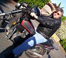
It's not a race, Neda...

Image
Meat Cove

Image
Posing on the Cabot Trail

Image
Our motorcycle gang!

The twists and turns were a welcome change from the slabbing we had been doing the last few days. And set against the backdrop of the blue waters of the Gulf of St Lawrence and the clear skies above just made the riding day perfect! Scenic pullouts regularly line the Cabot Trail every few kms, offering picture-taking opportunities of the coastline, but we pass those up, gobbling up the curves with unbroken rhythm!

Image
Irene takes the curves on the Cabot Trail

We ended the day at the Caribou and Munroe's Island Provincial Park, just outside the ferry that would carry us to Prince Edward Island tomorrow morning.
Gene

User avatar
jstark47
Site Supporter - Silver
Posts: 3538
Joined: Fri Feb 03, 2006 2:58 pm
Sex: Male
Years Riding: 16
My Motorcycle: '12 Tiger 800, '03 Trophy 1200
Location: Lumberton, NJ

Re: Quit our jobs, sold our home, gone riding...

#12 Unread post by jstark47 »

lightcycle wrote:We took a tour of the brewery and received some beers to take home with us. These are not the beers, we only got one each. Unfortunately, mine leaked in my top case on the way back. It's very hard to wash out the smell of beer. So right now I'm carrying a little bit of Quidi Vidi 1892 dark ale with me everywhere I go.
You could do worse. QV 1892 rules! I was up in NL in 2012 also, but later in the summer than you guys, and got introduced to QV brews. Wish I could get them down here in New Jersey.
2003 Triumph Trophy 1200
2009 BMW F650GS (wife's)
2012 Triumph Tiger 800
2018 Yamaha XT250 (wife's)
2013 Kawasaki KLX250S

User avatar
lightcycle
Veteran
Veteran
Posts: 61
Joined: Sat Feb 22, 2014 2:09 am
Real Name: Gene
Sex: Male
Years Riding: 11
My Motorcycle: 2006 R1200GS
Location: No fixed address

Re: Quit our jobs, sold our home, gone riding...

#13 Unread post by lightcycle »

jstark47 wrote:You could do worse. QV 1892 rules! I was up in NL in 2012 also, but later in the summer than you guys, and got introduced to QV brews. Wish I could get them down here in New Jersey.
We've been introduced to so many great beers in our travels!
Gene

User avatar
lightcycle
Veteran
Veteran
Posts: 61
Joined: Sat Feb 22, 2014 2:09 am
Real Name: Gene
Sex: Male
Years Riding: 11
My Motorcycle: 2006 R1200GS
Location: No fixed address

Re: Quit our jobs, sold our home, gone riding...

#14 Unread post by lightcycle »

Updatedfrom http://www.RideDOT.com/rtw/9.html on June 28, 2012

Image

We woke up early to catch the early ferry across the Northumberland Strait from Caribou, NS to Woods Islands, PEI, about 75 minutes from dock to dock. The only thing I knew about PEI was that we grew a lot of potatoes because of the fertile red earth.

Image
Early morning ferry trip to PEI

We spent most of the day riding around the coast of PEI. Unfortunately, the "scenic" route was a bit inland from the coast so the scenery consisted mainly of road and tree. We broke a bit from the scenery a bit to visit a lighthouse on the north-east corner of the island and to have a quick lunch.

Image
East Point Lighthouse, PEI

During a gas stop, an attendant asked us if we were all here for Atlanticade. We had no idea what that was. Apparently this weekend, over ten thousand bikers would flock to PEI to cross the Confederation Bridge to raise money for MADD. The rally centre was Summerside, just a half hour away from our campsite that we were staying that night on the north shore.

Again, our hectic East Coast schedule prevented us from staying the weekend. This pace was not what we wanted for our real trip and Neda and I agreed that we would take every opportunity to dawdle and lag to our heart's content when we wrapped things up in Toronto.


After lunch, we rode down to Basin Head, just outside Souris, PEI where we heard the sands sing when you walked along the beach! And they did! A loud squeaking noise as we shuffled our boots up and down the sandy shore. The sound occurs when the quartz sand is very rounded and spherical. As it rubs against each other, it makes a distinctive squeaking noise like you're rubbing two pieces of wet rubber together.

Image
Irene and Mel singin' in the sand - Photo by Ed C.

Image
All this squeaking is making Neda tired

Neda has bad allergies to the mosquito bites at all our campsites, so she's taking Reactin to counter the swelling. Unfortunately, the non-drowsy medication is making her drowsy (happens in a small percentage of people). Not good when you're on a motorcycle!

We set up camp on the north shore just outside Cavendish, as dark rainclouds rolled in. We've never put up our tent in the rain yet, and we were hoping to get the fly up before the waterworks started. As it turned out, we watched the rain fall from the comfort of an all-you-can-eat seafood restaurant, our tents already battened down.

Image
The view from our tentsite: morning sun on the north shores of PEI. Glorious!

Image
On the way out of PEI, I finally see red earth! And mutant giant broccoli on the left! :)

The next morning, we rode out of PEI via Confederation Bridge to New Brunswick. The 13 kms bridge's claim to fame is that it's the longest bridge in the world to cover ice-covered waters, not that there were any on this warm late July day. The Atlanticade motorcycle rally was set to ride this bridge a couple of days from now, and I could just picture 12,000 motorcycles riding back and forth. A lot of tired left arms waving to that many motorcycles!

Image
Our motorcycle gang approaches the curve on Confederation Bridge

We're spending a bit more time in New Brunswick on our way back to Ontario. This is truly the only bilingual province in Canada, almost everyone we meet along the way here speaks both languages fluently. Like PEI, I didn't know much about NB before coming out here, but what we really wanted to see were the Hopewell Rocks located in the Bay of Fundy, the inlet of water that's shared by New Brunswick and Nova Scotia.

Image

The Bay of Fundy is home to a unique phenomenon - the largest tides in the world. Over 100 billion tonnes of water flow in and out of the bay during each tide. And the tides happen twice a day, high and low tides occuring every 6 hours and 13 minutes on average! The tide differential may be anywhere between 10 to 14 meters!

Image
Flowerpot rocks at Hopewell

These bizarre rock formations called flowerpot rocks, are created by the erosion of the twice-daily tides. The larger heads of the rocks are the parts untouched by the high tide. During low tide, it is possible to walk on the sea-floor and between the flowerpot rocks. When low tide is not low enough to walk the floor, visitors often rent kayaks and canoes and paddle around the rocks. Very beautiful to see!

Image
A precarious situation at Hopewell Rocks

There are signs posted all over to be back on shore before high tide hits Hopewell. If you find yourself out on the rocks during high tide, the only options are to wait the 6 hours until the tide washes out, or swim back to shore!

Image
Walking along the sea floor

Image
Posing at Hopewell Rocks
Gene

User avatar
ceemes
Legendary 2000
Legendary 2000
Posts: 2153
Joined: Fri Jun 22, 2007 5:35 pm
Real Name: a big secret
Sex: Male
Years Riding: 26
My Motorcycle: 1998 Triumph Trophy
Location: Burnaby, BC, Canada, Sol 3, the Milky Way Galaxy, the Known Universe.

Re: Quit our jobs, sold our home, gone riding...

#15 Unread post by ceemes »

You guys are certainly living one of my major shoulda, coulda, woulda moments.
Always ask why.

Image

User avatar
lightcycle
Veteran
Veteran
Posts: 61
Joined: Sat Feb 22, 2014 2:09 am
Real Name: Gene
Sex: Male
Years Riding: 11
My Motorcycle: 2006 R1200GS
Location: No fixed address

Re: Quit our jobs, sold our home, gone riding...

#16 Unread post by lightcycle »

ceemes wrote:You guys are certainly living one of my major shoulda, coulda, woulda moments.
Thanks, we are having a great time. Hope to see you out here one day!
Gene

User avatar
lightcycle
Veteran
Veteran
Posts: 61
Joined: Sat Feb 22, 2014 2:09 am
Real Name: Gene
Sex: Male
Years Riding: 11
My Motorcycle: 2006 R1200GS
Location: No fixed address

Re: Quit our jobs, sold our home, gone riding...

#17 Unread post by lightcycle »

Update from http://www.RideDOT.com/rtw/10.html on July 15, 2012

Image

The ride back to Ontario from New Brunswick was a quick affair on the highway and was quite eventful, thanks to a broken master link on Khanh's VFR's chain. We put together two CAA calls to tow us from Perth, and then from Trenton back to Toronto, arriving at an ungodly 2AM. Alas, our test trip to the East Coast was over, now to prepare for the real thing!

Image
123,456 kms on the old girl. Not a bad way to start a trip...

After a hectic couple of days doing a last minute cleanup of our condo, we handed over the keys to the new owner. This was the last major tie to our old life and it felt like such a burden off of our shoulders, even if it meant we were now technically homeless. Thankfully, my parents put us up at their place while we sorted out the last of our affairs. We moved all our mail, bills, and registered our drivers licenses and insurance to their address. Two decades later, and I was back living in my parents basement! :)

Image
Giant Loonie in Sudbury

We left Toronto on July 15th, 2012 after saying sad goodbyes to our good friends and family, and happily severing our relationship with Rogers, Bell, Toronto Hydro and the Municipal Property Tax Collection Agency. This was it, for real now! As we headed north on the overly familiar Highway 400, it still didn't feel real. Still felt like we were on a day ride...

We stopped in Sudbury to take our obligatory picture in front of the giant Loonie outside of the Science North building. We must have 3 different shots of this from 3 different road trips. It was only once we traveled north of Sudbury that we felt like a dog that's broken it's leash, riding into new territory!

Image
Neda gazes at a lily pond on 108, just outside of Elliott Lake, north of Hwy 17

Part of our resolution for this trip is to take all the backroads that we never had time to explore because we had to make a destination for the night. We did learn some lessons from our trip out east though, which was that although we had the luxury of time, we traded for that at the expense of budget. So all the grocery shopping, preparing food, washing dishes and cutlery, setting up/tearing down of tents, etc. actually cost us a bit more time than if we had just checked into a motel at the end of the riding day and ordered a pizza or ate at a restaurant.

Image
Giant Muskoka chair outside the Pinecrest campsite in Thessalon. My theory is that little towns have to compensate by putting up oversize roadside attractions...

We stayed at a great campsite along the northern shores of Lake Huron, the beach was a few feet away from our tent and we relaxed on the shores for the evening and fell asleep to the sound of waves gently lapping the sandy beach. This camping thing is pretty new to me and I'm amazed that folks will park a camper for the summer at a campsite and make it their seasonal cottage! Lots of campers with patio stones, lawn gnomes and furniture outside!

Image
Our campsite at Thessalon

Image
Contemplating the nomadic existence

Image
I relax, Neda hikes. This is a common theme in our trips together. :)

The next morning, we venture out onto new roads. We're bypassing the very scenic Hwy 17 from Sault-Ste Marie to Wawa, since we've done it already, but I'd recommend it to anyone who's riding in the area - the sweeping turns and numerous elevation changes are made all the more spectacular by the sight of Lake Superior off the west side of the road.

Image
Hwy 129 Ontario

Instead, we're now riding Hwy 129 north from Thessalon. It's often called Ontario's Tail of the Dragon, because Tennessee 129 shares the same number. It's nowhere as tight and twisty, but the first 60 kms have amazing fast sweepers, great pavement and lots of 270 degree turns that have you leant over for what feels like an eternity! What a riot! The rest of the road is your normal Northern Ontario scenic route.

Image
Northern section of Hwy 129

As we reach Wawa in the afternoon, a light drizzle begins and darker clouds are approaching us. This is the first rainfall we've had on this trip. And it looks like we might have to put up a tent in the coming downpour...
Gene

User avatar
lightcycle
Veteran
Veteran
Posts: 61
Joined: Sat Feb 22, 2014 2:09 am
Real Name: Gene
Sex: Male
Years Riding: 11
My Motorcycle: 2006 R1200GS
Location: No fixed address

Re: Quit our jobs, sold our home, gone riding...

#18 Unread post by lightcycle »

Update from http://www.RideDOT.com/rtw/11.html on July 16, 2012

We reached Wawa just as the worst of the downpour started, and we ducked into the local Subway for a late lunch and to see if the deluge would let up before figuring out what to do for the evening. We really didn't want to be putting up a tent in the rain and the thought was, do we really want to be ducking into motels everytime it rains? That's the quickest way to burn through the travel dollars...

Image

As we mulled over our predicament, in strode a rainsuit-clad motorcycle warrior. He cased the joint and made a bee-line towards us.

"Who's the ADV Rider?"

Ah, my sticker on the back of my sidecase...

Jamie Z, fellow ADV Rider from Memphis, TN, chatted with us for a while. He was doing a road trip around the Great Lakes, headed to MN to visit some family. We told him of the great camp sites we had visited in the past few weeks and how cheap they were (compared to the hotels we had been staying with on our other trips). Little did I know we were talking to the author of Budget Travel the Jamie Z Way"! We got a crash course in how to sleep for free, eat on the cheap and different ways to stretch those travel $$$. Jamie told us how he stayed in a luxury cabin the night before and then got a seaplane ride around the lake this morning. ALL FOR FREE! Our meeting could not have come at a better time, at the beginning of this trip.

So, in the spirit of budget travel, and because Jamie seemed like a stand-up guy who wasn't going to make off with our iPhones, GPSs and my favorite pair of Crocs in the middle of the night, we offered to split the cost of a motel with him, seeing as how the rain just wouldn't let up.

Image
Big Goose statue in Wawa. Remember my theory about small towns?

As you can tell from this picture taken the morning after, we were still friends (after I confirmed that my crocs were still in my tankbag). We've taken a few pictures of the goose over the years and just recently, rust spots have appeared on the wings and body. The town is trying to raise funds to repair the statue. Poor goose! Jamie rode with us for a little ways and dropped back to do some sightseeing on his own, we would meet up with him again later on in the day.

Image
Chain maintenance. For once, it's nice to be shafted!

Image
Somewhere along the way we joined a motorcycle gang. And we all rode across bridges together.It was totally badass...

We took our time riding across the top of Lake Superior on Hwy 17, it was a clear, cool day, great for riding and we stopped to camp at a few provincial parks along the way. It was a leisurely way to say goodbye to our home province.

Image
At a gas stop, Neda makes a friend

This is Cabo, the Mini Parrot. We met a couple (from Montana I think) traveling across Canada by bike as well, and this was their traveling companion! Cabo just started speaking. His first word was, "Noodle!"

Image
On the right hand side panel you'll see Cabo's pillion seat, a tiny box where he can chillax.

Image
Bikes wait impatiently while we take a nap in Nipigon

At Sleeping Giant provincial park, we played beach volleyball with Savannah and the staff of the park. Savannah and her mother Jill were from Winnipeg, and Jill told us to visit Rushing River Provincial Park. So we did! Did I mention we are doing everything the locals recommend?

Image
Chillin in the waters at Rushing River Provincial Park

Image
Our campsite at Rushing River

We got off the main Hwy 17 and took a scenic bypass called Mom's Highway. Neda has this theory that if you name a road, motorcycle and car enthusiasts will come, ie. Tail of the Dragon, Cabot Trail, Sea-to-Sky Highway, etc. Mom's Highway was okay, bit more scenic than Hwy 17, but I'm sure if they called it Jo Momma's Highway, it would have kicked more "O Ring"...

Image
Terry Fox Memorial Statue in Thunder Bay overlooking the shores of Lake Superior.

As we approached Thunder Bay, we rode up to the Terry Fox Memorial. One of my first memories of Canada was watching Terry Fox run across the country on TV. I was only 9 years old at the time, and it was only later that I fully understood the magnitude of running a marathon everyday for 143 days straight after losing a leg to cancer. I don't get overly emotional, but my memories of his run, coupled with both of our families history with cancer made this a very special side-trip.

Image
Kakabeka Falls just outside of Kenora

Image

Kenora is one of the last towns on the TransCanada Highway before we leave Ontario. I have to admit, part of the reason why we visited Kakabeka Falls was because of the name. Our new euphemism on this trip for taking a dump is now "I have to visit Kakabeka Falls". I can tell by the look on Neda's face that she's visited Kakabeka Falls. I mean, it's right there in the background, is how I know...

Image

You know those stickers with the stick figure family that you see on the back of minivan windows? Neda got a couple of bike stickers for us. It's bad enough the Harley guys don't wave at me, now they openly mock us... :(

I've lived in Ontario for the last 31 years of my life, and it only took 5 days for us to make it out of the province. I'll miss the place, but most of all the family and friends that we're leaving behind.
Gene

User avatar
lightcycle
Veteran
Veteran
Posts: 61
Joined: Sat Feb 22, 2014 2:09 am
Real Name: Gene
Sex: Male
Years Riding: 11
My Motorcycle: 2006 R1200GS
Location: No fixed address

Re: Quit our jobs, sold our home, gone riding...

#19 Unread post by lightcycle »

Update from http://www.RideDOT.com/rtw/12.html on July 20, 2012

Image

Crossing over from Ontario into Manitoba on the TransCanada Highway we experienced a drastic change in geography. Gone were the irregular shorelines of Lake of the Woods, which in itself is quite spectacular when seen from an airplane. You can get a sense of this from the map above: the lake covers over 950,000 acres and has over 14,000 islands with over 30,000 kms of forested shoreline!

When we crossed the provincial border, it was like emerging from a forest into a wide open field. A field about 1,500 kms long... We had wandered out into the Canadian Prairies! We call it The Gap, that space between Ontario and the Rockies.

Image
The Market at the Forks

Just the other day, at the Terry Fox memorial in Thunder Bay, we were talking to a guy from Winnipeg and we asked where to go in the city. He replied, "The Forks". Having no idea what that was, we punched it in the GPS and were pleasantly surprised to find a nice little touristy area located in downtown Winnipeg, at the junction of the Assiniboine and Red River - hence "The Forks".

Image
Closeup of one of the structures surrounding Oodena Circle.

At one of the stores in the market, we overheard from the shopkeeper that there was a pow wow happening in the afternoon at the Oodena Celebration Circle, which was an open-air arena just outside the market. It was built by the city to host aboriginal and other cultural celebrations. "Oodena" is Cree for "centre of the city".

Image
Participants in brightly coloured traditional attire!

We stayed for quite a while at the pow wow listening to the drumming and chanting and watching the many different tribes come together and dance around the circle. It was a feast of colours, and Neda remarked that we had lived in Canada for so long, but here in Winnipeg was the first time she's seen First Nations people so interwoven into the city and culture.

Image

I found out later that we had actually visited The Forks on National Aboriginal Day, which was a pretty big event for Winnipeg. Some other shots of the Pow Wow:

Image

Image

Image

The Forks was built on a site that was originally (and still is) a meeting place for the last 6,000 years. It was a popular spot for trading between early aboriginals, European fur traders, Metis buffalo hunters, etc. all the way to current day stores selling curios to nomadic motorcycle riders. :)

Image
Human Rights Museum under construction at The Forks

Image
Walking the Espalanade Riel, a bridge just outside The Forks named after the city's founder, Louis Riel

Image
Thumpin' the doghouse!

I think what I'll miss most while being on the road is playing music. As far as entertainment goes, we don't watch any TV at all, but we did treat ourselves to an IMAX showing of The Dark Knight Rises. It was ok... I was very sad to hear about the tragedy in Colorado at the movie opening. These days, I get most of the news via social media, as I'm updating our pictures and blog online. Although we're seeing the world one small piece at a time, I'll have to be more diligent on keeping up with what's happening on a broader scale.
Gene

User avatar
lightcycle
Veteran
Veteran
Posts: 61
Joined: Sat Feb 22, 2014 2:09 am
Real Name: Gene
Sex: Male
Years Riding: 11
My Motorcycle: 2006 R1200GS
Location: No fixed address

Re: Quit our jobs, sold our home, gone riding...

#20 Unread post by lightcycle »

Update from http://www.RideDOT.com/rtw/13.html on July 23, 2012

Image

Our route through the interior provinces of Manitoba and Saskatchewan. We tried to stray off the main TransCanada Highway often, or we would have died of boredom! The fierce headwinds of the prairies really affected our fuel economy. With our large panniers and my huge Aeroflow windshield, our frontal surface area resembled the shape of a brick, and our range plummeted from about 350 kms/tank to 250 kms! Speed limits on the prairies are 110 km/h, which also contributed to our poor fuel mileage... :)

Image
Saskatchewan's license plate reads, "Land of living skies"

Image

We took a break off the boring flatlands of the Prairies and headed south towards the US border to an area called the Big Muddy Badlands. The town of Coronach runs a van tour that hits most of the touristy areas, but since we were mobile, we just visited them on our own. Most of the places on their web site are not that interesting anyway, and we saved ourselves $75!

Image
Taking a break on the gravel roads of the Big Muddy Badlands

The Big Muddy Badlands are these outcroppings of rock that look like they belong in a cowboy movie. You know the ones where the outlaw is running away from the US Marshalls, takes refuge in a cave in the hills and is in turn ambushed by Indians, and then all of them are chased by alien bounty hunters that look like Olivia Wilde...

Image
Castle Butte in the background

We spent most of the afternoon walking around Castle Butte, a large outcropping of sandstone and clay in the Big Muddy Badlands. It's the largest structure in the valley and was used by early settlers as a navigation landmark.

Image
Bikes in front of Castle Butte

Image
Exploring the spooky caves at Castle Butte. This one reminded me of the movie The Descent. Scary!

Image

Image

The badlands extend south into Montana, which boasts more desert landscapes, and is more typical of Western movies. Saskatchewan only has a tiny area of badlands north of the Canada/US border.

Image
Neda's butt walking around Castle Butte

Image
Neda surveying the view on top of Castle Butte

Image
Walking along the spine of Castle Butte

Image
Bikes in the background below

Image
GQ, here I come!

Image
Leaving Castle Butte
Gene

Post Reply