Page 2 of 3

Posted: Sun Jul 27, 2008 12:59 pm
by UTRider
Day 2: Thur July 24. So much for the plan.

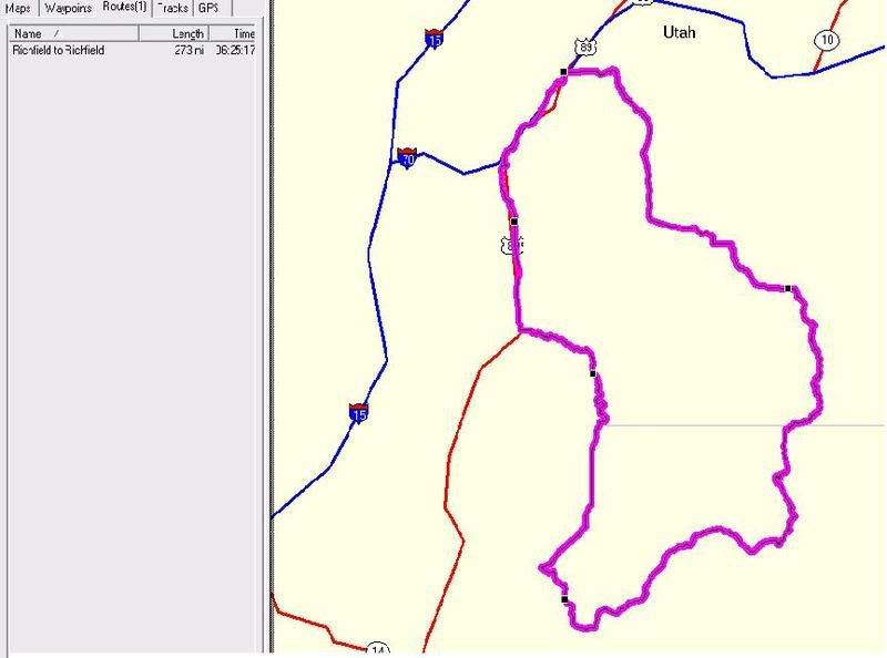
Plan for the trip was just a bunch of riding the roads around the Park City area. That and a couple of jobs that I scheduled with a company I do some part time contract work for. Not a lot of pay, but it will pay for the gas on the trip.

When I got to my brothers last night, he said a realator wanted to meet with the both of us on som property we are selling. Them my kids called and wanted to come down and ride the alpine slide. Looks like the rides are getting a little shorter.

So I head out, early, get the jobs completed and head into park city.

First road on the plan is Arie Driver. Nothing like going up a steep mountain road with multi million dollar homes to annoy the people in them. Still havn't got the pictures and video off the camera yet.

From the Arie, drop down the other side into Deer Valley and head up Royal Street to Silver Lake Lodge. Found out on the way up, that the camera stops running after 5 minutes. gonna have to look into that.

Drop down the back side of Deer Valley and decide a run up Gardsmans pass to the end of the pavement is in store. This time the camera shuts down after only a couple minutes. Change of batteries before the winter gate and check the settings. Hmmm camera will only run a max of 10 mins before shutting off.

Change the setting from 5 to 10 minutes and head up the last leg toward the top of Gardsman. Just past the gate, some of the ski runs cross the road. Those sections the pavement is completely gone. Couple turns later I decide the pavement is getting to broken and turn around and head back down.

In old town, do a couple of the steep streets at the top of main street (streets taht most tourists don't even know about.) Look at the time, and have to meet with the realator in an hour. Just enough Time to head out through some of the expensive condo's. Just about every road in Park City once you get off the main roads is turns. Granted you can't go super fast, but you know.

First 'aw crap' moment of the trip. Sign headed into the Three Kings area said "road work ahead." Fresh pavement down, but no lines. SUV behind me is trying to push me, so I'm going more or less the speed limit. Come around a turn and find the road construction.

New Pavement ends with about a 4 inch drop to the road that has been rotomilled for the new pavement.

Have one SUV behind me. To my right is a curb and gutter, and have an oncoming SUV in the other lane. As I jammed on the breaks, I know the guy behind me probably had heart failure, but all turned out good.

Do the meeting with the agent, wouldn't you know it, he has a LARGE poster of the deer valley area. I go over, look at it and get ticked off. Two more turns up gardsman and I would have been at the top grrr.

Kids show up with the ex-wife, So back up to the resort we head, the oldest still not sure if she wants to go on the alpine slide. Something about the stories her poor old dad and brother told her a couple years ago about the crashes we had on it.

After it was over, she wanted to know when I'd be back up to do it again. i think I've created a monster.

So then it's back to Heber to find out where they are going to shoot off the fireworks tonight. Stoped a couple of places to see if I could find out where the display was going to be, and well got misslead about the location. So as the sun set, I load up the camera gear on the bike, and head toward where my brother thinks they will be, then start following the traffic. Find a place along Deer Creek that people are parking, so figure that will be a good place to set up.

Guessing is was an interesting site. Had the tripod and camera set up, one bag handing off the tripod hook, and one hanging off the front of the bike, and me in lounch position on the bike.

I do have those downloaded and processed, but not to a size that would be acceptable on this blog, so I'll have to put a link to them later.

End of a long day, and headed for home tomorrow.

Posted: Tue Jul 29, 2008 11:22 am
by UTRider
Day 3: Fri July 26: Take the long way home.

All the business I was in Park City/Heber to take care of is done and time to head home. Get up early to pack and see the clouds are already boiling over the mountains. So I figure I had better get an early start and I think I'm going to get wet.

Going down provo Canyon I see the clouds are farther North, so I figure a short side trip to Robert Redford's Sundance Ski and Film resort can't hurt. Find out it's just 2 miles up the Alpine Loop/Highway 92. Sign says a couple other things are a little farther up the canyon. So after a quick look at Sundance up the Mountain I head. Just after a resturant/hotel/tourist trap is the pay station for the Alpine Loop. Now I havn't been on this road in 30 some odd years, and figure I'll see what it costs to drive up to Timpanogus Cave.

So I pull into a no parking area, walk over and ask the lady how much for a motorcycle to go up (sign says 6 bucks a car.) She asks where I'm going and I say "just want to hook up a camer to the bike and take pictures up to the top and come back down." To me the "top" is Timp Cave. She smiles and tells me to just go on up. Way cool.

So I head up. And up. And up.

http://www.youtube.com/watch?v=QNDVkjL3afk

Short little video of the 1 and a quarter lane wide road that goes up the mountain.

So then I reach the top of the mountain and still no Timp Cave. Well, that's what my original goal was, so down the other side. Finaly find Timp Cave about 10 miles from Alpine. So my choice is, continue down, or go back the 20 miles. I figure I'll stop at the pay station on this side and call it even. Wrong. 5 miles down the road, about 20 cars are waiting to pay to go up. Next time I'll just pay and feel good about it.

Not much excitement the rest of the way. But it's HOT. Found out that my MP3 player is like the camera. It will shut off after an hour if no buttons are pushed. That works out pretty good. About ever 50 miles I found a town to pull into, pull out a bottle of water and dump some over my head, then take off again. Near the end it was about every 30 miles once I got off the interstate. I carry 3 bottles of water with me on every ride. Since this was longer than I've done, I added two more bottles. Glad I did.

All said and done, 429 miles on the tree day trip. I won't be an "iron butt" person. But I just like to ride.

Posted: Tue Aug 12, 2008 6:43 pm
by UTRider
Well not much riding since the moonsoon has been fairy decent this year. Rain just about every afternoon. Working nights right now I would come out to a very wet bike, and possibly get rained on.

Tonight was a "temp mum nature" ride to Salina and back. Just a short 40 mile round trip . . but it worked the cobwebs out of the noggin.

To me, riding is a head clearer. Sound of the bike, the different smells in the air.

Remember when I was back in High School. We had spirit week, and one day we were to dress up as the "cowfolk" from one of the county rivals to make fun of them.

Now, like tonight. I like to jump off the freeway and ride the roads next to the fields. An irrigated field is like a swamp cooler and the cool air flows across the road. This time of year you also ride past fields with fresh cut hay . . . almost an intoxicating smell . . . don't know why.

Day off again tomorrow, hopefully I can get a little ride in again before the clouds and rain.

Posted: Wed Aug 13, 2008 6:39 pm
by flynrider
Hey UT,

Hope you rode on your day off. The day you posted this (Tue.) I spent most of they day crossing Utah the long way. Started at Tremonton at 9:00 AM and departed the state south of Kanab at about 3:00 PM.

Unfortunately, I was in a hurry, so most of it was via I-15. When I got onto U.S. 89 south of Filmore, things got a lot more interesting.

The week before I went from Vernal up 191 to Flaming Gorge. Then, instead of taking the well traveled eastern route, I picked up state route 44 going around the west end of the rec area, through the Ashley Nat'l Forests towards Manila. It was fantastic. Here's a pic I took of the western edge of Flaming Gorge, just below one of the passes.

Image

Posted: Tue Aug 19, 2008 6:31 pm
by UTRider
Looks like (at least tonight) the weather will co-operate for my longest ride yet -- The boulder loop. Plan is to start in Richfield, Ride to Torrey, up over Boulder Mountain on Highway 12. Short stop in Escalante, Then down to the entrance to Bryce Canyon and instead of continuing along highway 12 to highway 89, take a sharp North and ride up a county road through the Ghost Town of Osiris to Otter Creek.

Image

Yesterday we got a full 100 percent of the 5 percent chance of rain. Tomorrow 20 percent chance in the High Country. So I'm either going to be bone dry on the ride, or extremely wet!

Posted: Wed Aug 20, 2008 10:30 am
by aw58
Hi

sorry to hear you get rained on in Utah

If its anything like over here in UK my heart goes out to you.

Post some pics of the rain - I can't get enough of it - I'm thinking of changing my name to Prince Namor

Ade

Posted: Wed Aug 20, 2008 5:24 pm
by UTRider
aw58 wrote:Hi

sorry to hear you get rained on in Utah

If its anything like over here in UK my heart goes out to you.

Post some pics of the rain - I can't get enough of it - I'm thinking of changing my name to Prince Namor

Ade
Eh, I probably shouldn't complain about it raining. I live in a VERY dry area. The entire year we get 6 inches of rain, most of that in a 5 month streatch. You think Utah, and lots of deep powder for skiing (If only my battered knees would let me again), but the snow is "dry" snow. An inch of snow will only have between .01 and .05 inch of water in it. So it takes a LOT of snow to get 1 inche of water!

Posted: Wed Aug 20, 2008 6:27 pm
by UTRider
August 20: Boulder Loop

If I ever get off to an "on time" start on my adventures it will be amazing. Had planned on being on the road by 9:00 am. Wouldn't you know it I set the alarm wrong and didn't even roll out of bed till 9:30.

Map program says 273 miles and six and half hours of riding. Quick check of the skies -- not a cloud. But that's not unusual for this time of year. Have the rain gear, couple bottles of water, and a bottle of sports drink so it's off we go.

Fist leg: Richfield to Torrey.

One of the boring sections of the Boulder Loop. A few Small towns, but you do go up over the Fishlake Basin and what is called Wayne Summit - it can get real nasty during the winter.


Mostly Flat and strait near Koosharem
Image

Taking a quick stop for the Wayne Summit sign.
Image

First stop for a break is in Torrey. I could probably make it on one tank to Escalante, but considering it's all uphill from here, and no cell phone service. Why take the risk.

Leg 2: Torrey to Escalante

Now I remember why I wanted to leave earlier. Hit Torrey during the High School Lunch Hour. Both Gas stations have fast food resturants in them. So It's dodge the teen drivers then Head uuuh South (even though highway 12 runs east and west hehe.)

This is the end of highway 12 by way of mile markers, but my start up the hill.
Image

Just as it starts to get fun, a car with Grandma and Grampa is in front of me (well okay they were elderly) and doing waaaay under the limit. Lucky for me, they slowed down even more and pulled to the side to let me by (Yes I see I have a passing area, but not far enough to pass them until the let me.)

Going for the pass
Image

Now with open road, it's more or less the speed limit to the top. With a lot of twisties.
Image

Then it's the summit. I forgot to stop and get a picture of the sign, but I'm now about 9,700 feet above sea level.
Image

You got it more turns down the backside.
Image

After going through boulder, it's the part of the loop I hate. Hogs Back. Why do I hate it? Well, I don't like high places. Heart rate goes up, start sweating, realy don't like it. Well hogs back is a ridge line. Just wide enought for two lanes of blacktop. Other side of the white line? about a foot of pavement, then it starts downhill. According to my GPS, from the top of Hogs Back, down to the entrance to Calf Creek Falls it's 1,500 feet. Yea NO railings along it either. This pic isn't from this trip, but one I did in the cage a couple years ago.

View standing just off the white line looking east off hogs back.
Image

This is another *fun* portion.
Image

So now that the nerves about about completely shot. Pull into Escalante for another top off of fuel and lunch.
Image

Escalante is a must stop for fuel. Well okay if not here than either in Tropic or the entrance to Bryce Canyon becuase I'm turning off before highway 89 so I can't stop in Panguitch or Circleville. Once I leave Highway 12 at Bryce Canyon, it's nothing but desloate road until Antimony, but I'll have plenty to make it to Marysvale before stopping again.

Leg 3: Escalante to Marysvale.

One interesting note about Escalante. Here is one of the roads that will take you over Hell's Backbone. If you read Beemerchef's blog, he went over it this year. My bike wouldn't make it. So that's one I'm going to have to do in my Jeep. From Escalante it goes up the long way to the Boulder side of Hogs back.

I'm Fueld up, the bikes fueled and it's off we go. Couple more streatches of turns . . okay quite a few more. Now I don't go wild in the turns -- just at a white I feel comfortable pace. Though I was doing pretty good (more or less the speed limit), when three harleys pass me on a strait. Ah well -- I'm having just as much fun as they are (maybe in my mind, but not theirs.)

Along Highway 12, you'll come to a turn South that goes to Bryce canyon. At that Junction, is where I head North on Johns Valley Road. Map says there's a Ghost town called Osiris along the way, and they are always fun to take a stop at.

Here's the start of Johns Valley Road
Image

One of the canyons along Johns Valley Rd
Image

No Pictures of Osiris. I was looking for an old town, only think I could find was what looked like an old mill and a house across the road from it. After I got home . . I looked it up and well Osiris was ONLY the mill and the house. Ah well, I'll have to head back that way again some time.

Pulling into Antimony
Image

I've been told by many here in town that I should stop by the Merc in Antimony for a burger and pie. Well, a groupe of hunters beat me to the place and had snatched up all the pie's that had cooked today, so I just had a burger (not bad really), and headed out again.

Just down from Antimony is Otter Creek Resivour. Glad I have enough Fuel to get to Marysvale. Lone gas station at Otter was $4.50 a gallon! Most places in Central Utah have droped to under 4.

Filling up in Marysvale I look down and notice something.
Image

I've rolled over to 11k miles. That means I've put 2,000 miles on it since it became new to me at the end of April. Had my gold wing almost three years and didn't put that many on it. Well, I guess it helps that the new to me bike isn't in the shop every other week. (you can also see it's 121 miles from Escalante to Antimony.)

Last Leg: Marysvale to Richfield.

About this point I'm thinking just 30 minutes to home, that's all I have to last. This has been the longest ride for me so far. I packed the camera in the bag at marysvale. I was in for a surprise. From Big Rock Candy Mountin to I70 they have repaved highway 89. No more tar snake city . . so I was able to more or less do the speed limit in the canyon.

Pull into the parking lot and look down at the GPS for the silly numbers you can keep track of. From the First Fuel stop, to turning the key off

Miles: 280
Total Time 8 hrs 03 min
Total moving time 5 hr 52 min.
Max speed: uuuh well it was more or less the speed limit on the interstate 8)

Posted: Thu Aug 21, 2008 5:06 am
by noodlenoggin
Cool blog, I've been following along since the start. I love the photography -- you live in an area so totally different from where I live, and it's neat to see all those wide-open spaces. Keep it up!

Posted: Thu Aug 21, 2008 10:11 am
by UTRider
noodlenoggin wrote:Cool blog, I've been following along since the start. I love the photography -- you live in an area so totally different from where I live, and it's neat to see all those wide-open spaces. Keep it up!
Thanks noodle

But today I feel like I was hit with a Mac truck. Won't be doing any Iron Butts any time soon. But I have a couple of places in mind the next couple months (before winter gets here.)

I'm a Pro-am photographer. Most of the pics in this blog will be from a little point n shoot Kodak. Have a RAM mount on the handle bars. Can take stills or Video. Then I have a program that pulls stills out of the video. Hopefully next couple of days I'll get some of the video up on youtube.

(my Pics with the good camera are at www.pbase.com/snowphoto )