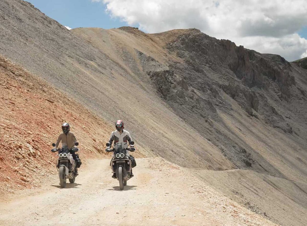
Each trail in the Dirty Dozen Challenge event presents a unique set of obstacles with ever-changing conditions. From grueling rocky climbs, river crossings, to steep descents, prepare for a thrilling adventure across some of America’s most stunning scenery. Welcome to Inspiration Friday: Ducati Dirty Dozen Challenge! Complete 12 Colorado mountain peaks featuring: old mining trails, picturesque mountainsides, rugged terrain, captivating alpine vistas, breathtaking panoramic views, narrow switchbacks, breathtaking drops, serene valleys, cascading waterfalls, and magnificent wildflower meadows! An unforgettable journey immersed in Colorado’s rich history is for adventure riders seeking an adrenaline rush as you conquer the twists and turns in this adrenaline-pumping adventure. Do it all and earn the coveted “Dirty Dozen” badge!
Inspiration Friday: Ducati Dirty Dozen Challenge is a must-ride destination for any adventurer seeking natural grandeur. Immerse yourself in the serenity of the Colorado Rockies and Total Motorcycle, your adventure awaits.
Plus as an added bonus, OnX Offroad is also offering a free five-month trial for DesertX & Multistrada owners, providing them with the same tool to create their own adventure. If you own one of those great Ducati’s, your welcome for the freebie brought to you by TMW.
See Total Motorcycle’s huge 2023 and 2024 Ducati Motorcycle Model Guides, the best in the business for riders of all skill levels.
Don’t forget to support us to support riders worldwide. We could always use more gas in the tank!Total Motorcycle would like to thank BMW, Yamaha and our over 400 million of motorcycle riders and enthusiasts who visit and support TMW for inspiring us to bring you this week’s Inspiration Friday: Ducati Dirty Dozen Challenge! Each week we bring you another Inspiring Motorcycle story to inspire you to get out and ride. Please help us by joining Total Motorcycle’s new YouTube Membership and $2/mo Patreon channels or by donation. This may be the last Inspiration Friday without your support. Please help us help riders, support motorcyclists and motorcycling worldwide today. Thank you. |
Ducati North America Launches “Dirty Dozen” Challenge for DesertX
- Complete 12 Colorado mountain peaks on a DesertX to earn the coveted “Dirty Dozen” badge
- Curated routes designed to test the off-road capability and adventure-ready features of the DesertX
- Ducati partners with onX OffRoad, the most accurate GPS mapping tech for off-road enthusiasts
Sunnyvale, Calif., – August 3, 2023 – Ducati presents the “Dirty Dozen Challenge,” an epic journey that takes DesertX clients across a dozen 12,000+ foot off-road mountain passes in the breathtaking Colorado Rockies. This challenge, created and completed by North American CEO, Jason Chinnock, showcases the full capabilities of the DesertX in an environment known for its iconic and challenging adventure riding.
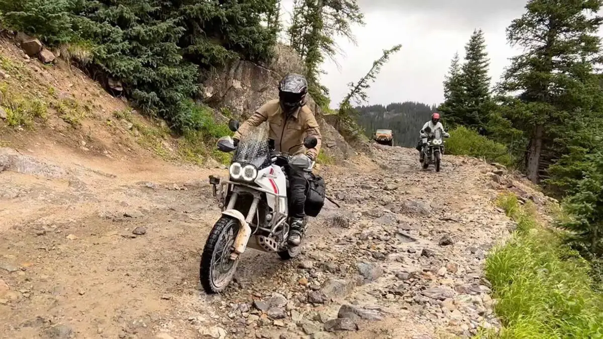
“Immediately after I saw the concept sketch of the DesertX in Ducati’s Centro Stile, I was inspired to design an adventure to prove it’s more than just a beautiful design but also technically capable of tackling some of the most difficult passes in the Rocky Mountains as an average rider,” reflected Chinnock. “Each trail in the Dirty Dozen Challenge presents a unique set of obstacles with ever-changing conditions. From grueling rocky climbs, river crossings, to steep descents, prepare for a thrilling adventure across some of America’s most stunning scenery. Experience picturesque landscapes while navigating these challenging routes and visiting the historic towns.
Ducati has partnered with onX Offroad, a leading off-roading mapping app built for adventure. Ducatisti can access the “Dirty Dozen” routes, freely discover nearby trails, plan and track trips, create 3D maps and share their routes. Everything riders need to know—from land access details to trail openings and weather forecasts—is all in one app. OnX Offroad is also offering a free five-month trial for DesertX & Multistrada owners, providing them with the same tool to create their own adventure.
Riders who complete the “Dirty Dozen” share images on social media with the proper tags and hashtags will receive a limited-edition badge to apply to their DesertX — a unique insignia that is only earned with this achievement.
To prove the ability to complete the “Dirty Dozen” a three-episode video series documents each route and challenge. To view the episodes, learn more information about the challenge and how to enter visit the official Ducati Dirty Dozen page.
Introducing the Ducati Dirty Dozen – Conquer the Rockies and earn your Badge
Welcome to our off-road adventure challenge designed to inspire DesertX riders.
Ducati Dirty Dozen is a curated series of mountain passes that will test your skills and create lifelong memories. The expansive network of Colorado mountains and off-road trails serve as the perfect backdrop for this remarkable adventure challenge.
The Challenge
The Dirty Dozen consists of twelve specially selected mountain passes, each exceeding 12,000 feet above sea level. Nestled in the heart of the Colorado Rockies, these trails are a magnet for Adventure Riders across North America, and now it’s your turn to conquer them.
Your journey begins as you follow the paths of old mining trails, weaving through picturesque mountainsides that offer a constantly changing terrain. Prepare yourself for the challenges that lie ahead across ever-shifting conditions and stunning summits that will test your skills and ignite your spirit.
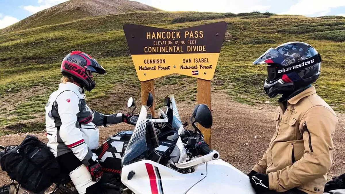
But this isn’t just about the ride; it’s about capturing the moment and sharing your achievements to inspire others. At each mountain pass, seek out the iconic “Signpost” and document your achievement. Share your images on social media, tagging @DucatiUSA and using the hashtag #DucatiDirtyDozen.
Mountain Passes
Conquer the Mountain Peaks below and wear that badge of honor for completing the ‘Dirty Dozen’. Click on the passes below for trail overviews, difficulty, history, and more.
Imogene Pass – 13,114 ft
Imogene Pass stands tall at 13,114 feet, offering riders a thrilling ascent through rugged terrain and captivating alpine vistas. As one of Colorado’s highest mountain passes, Imogene will test your skills while rewarding you with breathtaking panoramic views.
- Total Miles 11.9
- Elevation 4,020.64 ft
- Duration 4 Hours
- Technical Rating 6 Difficult
- Best Time Summer, Fall
Trail Overview
This is an absolutely phenomenal experience. You will go through one of the most active mines in the state, Tomboy Townsite, at Savage Basin. There is a lot of debris in the area and it is on private property. Take care to stay on the route. Unlicensed vehicles aren’t allowed on the lower half of south side, but can start the trail further on. The road is open from May 16 to November 30. Snow may be blocking the road through early July.
Difficulty
Difficult. Do not take this trip lightly. The road is rocky, steep and narrow in places and passing can be dangerous. Stock SUVs should have low-range gearing, 4-wheel drive, high clearance and skid plates. Experienced drivers only.
History
Work at the Tomboy Mine began in the 1880s and continued until 1927. The mine was a rich producer of gold, and at one time 900 people lived in Savage Basin, the large glacial cirque below the mine. Many people lived there all year long, and snow tunnels were the only way to get around during the long, cold winters. A fascinating book, Tomboy Bride by Harriet Fish Backus, wife of an assayer, tells what it was like to live in the camp.
Black Bear Pass – 12,840 ft
Black Bear Pass presents a formidable challenge for adventure riders seeking an adrenaline rush. With its steep descents, narrow switchbacks, and breathtaking drops, this pass is not for the faint of heart. Brace yourself for an exhilarating and heart-pounding ride.
- Total Miles 11.1
- Elevation 3,914.13 ft
- Duration 2 Hours
- Technical Rating 6 Moderate
- Best Time Summer, Fall
Historic mines and breathtaking waterfalls, including Bridal Veil Falls are just a few of the sights along this mountain trail. You can turn around before you reach the one-way, downhill switchbacks. If you’re in an unlicensed vehicle, you should take that option or plan to be picked up at the bottom of the trail. The road is closed from October through May 15. Black Bear Pass is one of the best-known Jeep trails in the State. It has a reputation for killing people. It is possible to die on this trail, but that is true for most of the trails in the Rocky Mountains. You have to be careful and use common sense wherever you are. This is an easy 6-rated trail, but if I gave “Pucker Factor” ratings this one would be off the chart your first time down. The scenery is great. There are two significant waterfalls, nice views of the San Juans, and an overview of Telluride. The trail is two-way as it begins on US 550, but switches to one-way at the point it gets narrow and scary. There are very few spots wide enough to pass from here on down. The road from US 550 to the actual Black Bear Pass is another beautiful Rocky Mountain road. There is a spur road at the timberline that leads to Porphyry Gulch, then the trail goes up, up, and up toward the pass. As you top the pass the road drops down into the upper basin. You then drop from there into a still lower basin. Then drop into yet a third basin. After the edge of the third basin, the road drops steeply toward Telluride. At the bottom of this drop, you reach a sign indicating that the trail is one-way from here down. You will soon reach the worst “Pucker Point” of the trail. This section is called “The Steps”. The road is a solid ledge, but it is a bit off-camber, somewhat narrow and there is a big drop on the driver’s side. This is the scariest part. Be careful. Think about what you are doing and you will be OK. Remember, tour companies take tourists down this. OR, you can do what I did – let your wife drive so you can take photos.
Difficulty
Very rocky, rutted and off-camber trail with erosion, loose rocks, sand, washes and obstacles up to 3 feet tall, including ledges and short, steep grades. Potential for deep water crossings with strong currents.
Cinnamon Pass – 12,620 ft
Immerse yourself in the beauty of Cinnamon Pass, where the alpine scenery unfolds before your eyes. This pass offers a mix of serene valleys, cascading waterfalls, and magnificent wildflower meadows, creating a picturesque setting that will leave you in awe.
- Total Miles 24.2
- Elevation 3,847.19 ft
- Duration 3 Hours
- Technical Rating 3 Easy
- Best Time Summer, Fall
Trail Overview
Enjoy this section of the famous Alpine Loop, which can be combined with the Engineer Pass. Take Wager Gulch up to Carson Ghost Town, and take Cinnamon Pass Road up to American Basin for wildflowers. Staging is available on the western side across from Eureka Campground. Staging area options on the east side.
Difficulty
Moderate. Most of this trail is easy; however, the western end is steep and rocky in a few places. The side trip up Wager Gulch is more difficult. All roads, when dry, are suitable for any stock 4×4 SUV with moderate ground clearance. The side trip up American Basin is borderline difficult.
Engineer Pass – 12,780 ft
Engineer Pass takes riders on an unforgettable journey through rugged landscapes and old mining remnants. As you navigate this pass, you’ll be immersed in Colorado’s rich history while marveling at the stunning mountain views that surround you.
- Total Miles 20.4
- Elevation 3,948.64 ft
- Duration 3 Hours
- Technical Rating 4 Moderate
- Best Time Summer, Fall
Trail Overview
This trail is one portion of the Alpine Loop. There is something for all levels and a lot of unique historical sights to see. When you reach the east side, you’ll follow Henson Creek. This is a great place for camping and fishing.
Difficulty
Moderate. The majority of the drive, coming down the east side of the pass, is easy. However, the west side, between Wpts. 01 and 02, is very steep, narrow and rocky in spots. Caution should be used at all times especially in wet weather. Novice backcountry drivers may be intimidated. Don’t drive if snow covered. You’ll want 4-wheel drive with low range gearing and high ground clearance. No seasonal closures except by weather.
History
Engineer Pass Road was a major stagecoach and freight route when it opened in the late 1870s. Like so many other roads in the area, it was built by Otto Mears as a toll road. Watch for kiosks along the route that describe key features. Take some time to see the town of Henson and the Ute-Ulay Mine. The mine was discovered in 1871 and sparked the development of Lake City.
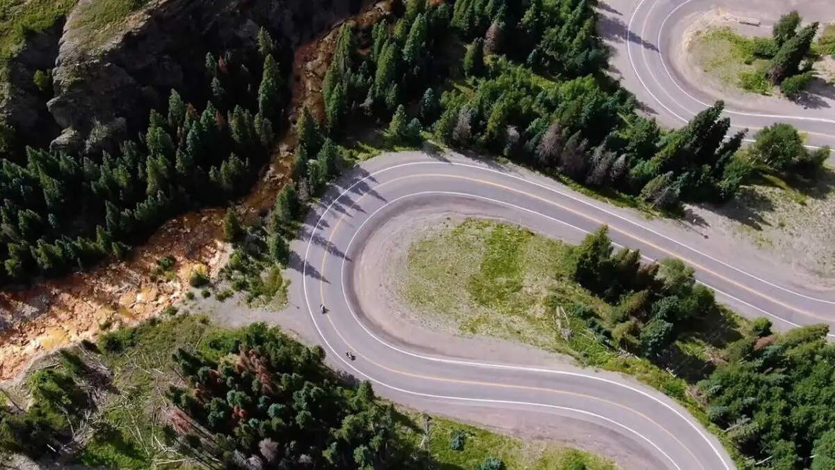
Corkscrew Pass – 12,220 ft
Prepare for an adrenaline-pumping adventure on Corkscrew Pass. With its tight switchbacks and challenging terrain, this pass will put your off-road skills to the test. Be ready to conquer the twists and turns of this thrilling trail.
- Total Miles 7.1
- Elevation 3,873.42 ft
- Duration 1.5 Hours
- Technical Rating 3 Moderate
- Best Time Summer, Fall
Trail Overview
Wind between two peaks of the Red Mountains and enjoy some really beautiful country. Logging trucks are common on the lower portion of the trail. Parking and camping are available at the bottom of the trail. From here you can also check out Gray Copper Gulch.
Difficulty
Moderate. Easy when dry. The road is wide and graded most of the way; however, one section of narrow switchbacks at the top may be intimidating to novice drivers. If wet, the trail becomes more difficult due to slippery clay soil.
History
Just south of where Corkscrew Gulch leaves U.S. 550, several roads wind around in the trees. Here and there, a building can be found. This is all that remains of the once important mining town of Ironton. In 1890, the town provided supplies for many rich mines in the area and had a population of over 300. The town had its own water system, an electric plant, fire department and post office. The town managed to survive long after the silver market collapsed around the turn of the century. People actually lived in Ironton until the 1960s. The lumber from the buildings was carted off over the years, so not much remains.
Hurricane Pass – 12,700 ft (Editor note: Appears same as Corkscrew Pass)
Hurricane Pass promises an exhilarating ride through striking mountain scenery. As you ascend to its lofty heights, you’ll be greeted by sweeping vistas, towering peaks, and the invigorating rush of conquering this impressive pass.
Prepare for an adrenaline-pumping adventure on Corkscrew Pass. With its tight switchbacks and challenging terrain, this pass will put your off-road skills to the test. Be ready to conquer the twists and turns of this thrilling trail.
- Total Miles 7.1
- Elevation 3,873.42 ft
- Duration 1.5 Hours
- Technical Rating 3 Moderate
- Best Time Summer, Fall
Trail Overview
Wind between two peaks of the Red Mountains and enjoy some really beautiful country. Logging trucks are common on the lower portion of the trail. Parking and camping are available at the bottom of the trail. From here you can also check out Gray Copper Gulch.
Difficulty
Moderate. Easy when dry. The road is wide and graded most of the way; however, one section of narrow switchbacks at the top may be intimidating to novice drivers. If wet, the trail becomes more difficult due to slippery clay soil.
History
Just south of where Corkscrew Gulch leaves U.S. 550, several roads wind around in the trees. Here and there, a building can be found. This is all that remains of the once important mining town of Ironton. In 1890, the town provided supplies for many rich mines in the area and had a population of over 300. The town had its own water system, an electric plant, fire department and post office. The town managed to survive long after the silver market collapsed around the turn of the century. People actually lived in Ironton until the 1960s. The lumber from the buildings was carted off over the years, so not much remains.
California Pass – 12,900 ft
California Pass offers an incredible off-road experience in the heart of the Rockies. This pass showcases the majestic beauty of Colorado’s wilderness, from expansive valleys to rocky slopes, making it a must-ride destination for any adventurer seeking natural grandeur.
- Total Miles 4.9
- Elevation 3,935.24 ft
- Duration 1 Hours
- Technical Rating 3 Easy
- Best Time Summer, Fall
Trail Overview
This trail starts at the Animus Forks Ghost Town, and the start of the famous Alpine Loops. This is a remote and beautiful drive that passes by many old mining buildings. Make time to stop for the outstanding vistas. This trail is not passable in the winter.
Difficulty
Easy. Road is in good condition most of the summer. Heavy snow on east side of California Pass is usually plowed by late June. Low range recommended for upper portion of trail.
History
Animas Forks was active between 1875 and the early 1920s. In 1885, its summer population reached a high of 450 people. The Silverton Northern Railroad reached the town in 1904 when the giant Gold Prince Mill was built. The mill lasted only six years before it was closed.
Stony Divide Pass – 12,588 ft
Stony Divide Pass invites riders to explore a remote and rugged terrain, where rocky trails wind through pristine wilderness. Prepare to immerse yourself in solitude as you navigate this challenging pass, surrounded by breathtaking mountain peaks.
- Total Miles 38.6
- Elevation 3,839.49 ft
- Duration 3.75 Hours
- Technical Rating 4 Moderate
- Best Time Summer, Fall
Trail Overview
Stony Pass is another way to get from Silverton to Highway 149, although it is not a great way. The Jeep trail is not very difficult, but it is 38 miles long and the section from Kite Lake to the Rio Grande Reservoir (10 miles) is bumpy and boring. From there Highway 149 is well graded. Unless you are simply looking for something to do, spend your time west of Kite Lake. One of the most interesting things about the descent on the east side of Stony Pass is the fact that you can see small streams along the trail. These are streams starting at the Continental Divide and they are the headwaters of the Rio Grande River. As you start up the west side, watch for what is left of the Buffalo Boy aerial tramway with a few tram buckets still attached. The Buffalo Boy trail will take you to the upper end of the tramway. Wildflowers are fantastic on the west side of the pass if you are there at the right time of the year – a bit later in the season than most of the San Juans. Sheep will be grazing all the high country at certain times through the summer. Stony Pass is 12,592′ in elevation.
Difficulty
Uneven, rutted dirt trail with loose rocks, sand, erosion, and washes. Potential water crossings up to a foot deep, mud holes, and obstacles up to 18″, including ledges and short, steep grades. Roads are typically one vehicle wide with places to pass.
Tincup Pass – 12,154 ft
Tincup Pass promises an unforgettable adventure through a historic mining region. As you traverse this pass, you’ll witness remnants of Colorado’s mining heritage while being captivated by the stunning alpine landscapes that unfold before you.
- Total Miles 12.7
- Elevation 3,706.11 ft
- Duration 2 Hours
- Technical Rating 5 Difficult
- Best Time Summer, Fall
Trail Overview
Tour historic mountain towns on this beautiful high-mountain pass. Visit St. Elmo, a popular Colorado ghost town with a few businesses, including an ATV rental. Tincup is a cute town with lots of historical buildings. No gate-closures on this trail.
Difficulty
Difficult. Sharp rocks near the top may cut tires. One short section of narrow shelf road often remains snow covered into early July. After the snow clears, this trail is suitable for SUVs with high clearance, low-range gearing, skid plates and good tires.
History
St. Elmo was settled in 1878 and grew to a population of about 2,000. Like so many mining towns, the most prosperous businesses were saloons, dance halls and bawdy houses. In 1881, St. Elmo became an important railway stop. During the construction of the Alpine Tunnel, St. Elmo was a bustling supply center. When Mary Murphy Mine closed in 1920, St. Elmo was finished. Contrary to popular belief, Tincup is not a ghost town. Most of the old cabins in town have been restored to their original condition and are occupied during the summer. No visit to Tincup is complete without a stop at the Tincup General Store.
Cumberland Pass – 12,034 ft
Cumberland Pass beckons riders with its serene beauty and a sense of solitude. This pass offers a tranquil escape into nature, where you can ride through peaceful valleys and immerse yourself in the serenity of the Colorado Rockies.
- Total Miles 17.4
- Elevation 3,667.97 ft
- Duration 3 Hours
- Technical Rating 6 Moderate
- Best Time Summer, Fall
Trail Overview
Take this scenic trail parallel to Cumberland pass. These old mining roads take you to some historical sights, and an incredible 360-degree view at the peak of Napoleon Mountain. Feel free to explore more of the mining roads you find, but be sure to stay on the roads and off public property. These are old mining roads, so there are a few steep, rocky and narrow climbs.
Difficulty
4WD is not usually needed, but these are narrow, steep, rocky mining roads. Some may be covered in snow through July.
History
Cumberland Pass had a pack trail originally, where burros hauled supplies in, and ore out, of the Tincup mining district. In 1882, the trail was widened to a wagon road over the 12,000-foot pass. This allowed direct access from the Tincup area to the Denver, South Park, and Pacific railroad that came over the Alpine Tunnel to Pitkin. There were mines on both sides of the pass, which used Cumberland Pass, to transport ore and bring in supplies. Past the first switchback on the Pitkin side was the Bon Ton Mine. The first automobile crossed Cumberland Pass in 1905, but it had to be pulled by a team of horses part way. In 1935, the Civilian Conservation Corps improved the road. In the 1950s it was upgraded again.
Hancock Pass – 12,208 ft
Hancock Pass offers riders an opportunity to experience the best of Colorado’s backcountry. This pass showcases the region’s natural beauty with its dense forests, picturesque meadows, and glimpses of wildlife, creating a serene and captivating riding experience.
- Total Miles 16.8
- Elevation 3,702.66 ft
- Duration 3.5 Hours
- Technical Rating 5 Difficult
- Best Time Summer, Fall
Trail Overview
This trail connects St. Elmo to Pitkin by way of 12,140-foot Hancock Pass. After taking in the views, descend to Brittle Silver Basin and on through to Pitkin and a long drive back to Highway 50. As an alternative you can climb up the 12,015-foot Cumberland Pass to Tincup and take Tincup Pass back to St. Elmo. This trail may close unexpectedly for snow.
Difficulty
Difficult. Most of the trail is easy wide road. At the pass, very rocky and slow-going, but okay for aggressive stock SUVs with low range and skid plates. Do not attempt if snow is present.
History
Hancock Road and the Alpine Tunnel Road were built along the original railroad grade that passed through the Alpine Tunnel in the 1880s. Several railroad structures still remain. Forest Road 839 was damaged at the Palisades by an avalanche in February 2016, and the road remains closed. It was hoped that Williams Pass Road would open as a way to reach tunnel, but so far, it’s not.
Mosquito Pass – 13,185 ft
Mosquito Pass is not for the faint of heart. As one of Colorado’s highest passes, it presents a challenging ascent along a steep and rocky path. Enjoy the breathtaking views from the mountain’s pinnacle.
- Total Miles 10.7
- Elevation 4,017.25 ft
- Duration 2.5 Hours
- Technical Rating 4 Moderate
- Best Time Summer, Fall
Trail Overview
Make sure you are acclimated to the altitude before riding the highest road open to motorized vehicles in Colorado. Climb all the way up to 13,185 feet and enjoy the views. Take some pictures of old mine structures on the east side. This trail connects to the difficult Birdseye Gulch trail.
Difficulty
Moderate. The upper portion of the trail is narrow and rocky on both sides of pass but suitable for aggressive, high-clearance, stock SUVs with low range. Road is closed when blocked by snow, which can occur well into late summer following a hard winter.
History
This short-lived trail was actively used in the 1870s as the quickest way to reach western mining activities. Like so many of these high pass roads, travelers eventually found it easier to take longer but lower routes like Weston Pass. In the late 1870s, Leadville was the most famous silver mining camp in the world, and by the 1890s, it was the second-largest city in Colorado. Today, Leadville is home to the National Mining Museum. The headstone at the summit honors Father Dyer, ‘The Snowshoe Itinerant.’ Starting in 1861, he spent 29 years preaching at mining camps along the mountains. He became a legend by carrying mail and gold across the pass sometimes twice a day. At least one trip took him 3 days to dig through the snow.
Please note: In order to use the routes above, you will need to download the OnX Maps app on your device.
Get a Taste for What’s Ahead
Ducati North America CEO Jason Chinnock and Jamie Robinson of MotoGeo set out to tackle the Dirty Dozen Challenge in just five days and document their adventure.
Across these five exhilarating days, they conquered all twelve peaks, tackling every climb, water crossing and narrow mountain trail. Be prepared to be inspired to test your own riding abilities and embrace the spirit for adventure that fueled their quest to conquest the Dirty Dozen.
Twelve peaks, 5 days, and all offroad.
Join us as we unveil the Ducati Dirty Dozen Challenge through the lens of MotoGeo. Prepare to be captivated, inspired, and left yearning for your own adrenaline-soaked adventure.
Don’t miss out—watch the three gripping episodes that will transport you into the heart of the action. The Ducati Dirty Dozen awaits you!
The Reward
To claim the “Ducati Dirty Dozen” badge, complete all twelve mountain passes and provide proof for each one. Your collection of twelve images, featuring you, your DesertX and the required tags, rewards you as a Ducatisti who conquered this challenge.
Submit Your Entry
Please send your submission to [email protected] and provide the below information in your email.
- Your name
- Instagram handle
- Ensure you have all 12 photos of you and your DesertX at the signpost, tagging @DucatiUSA and #DucatiDirtyDozen


